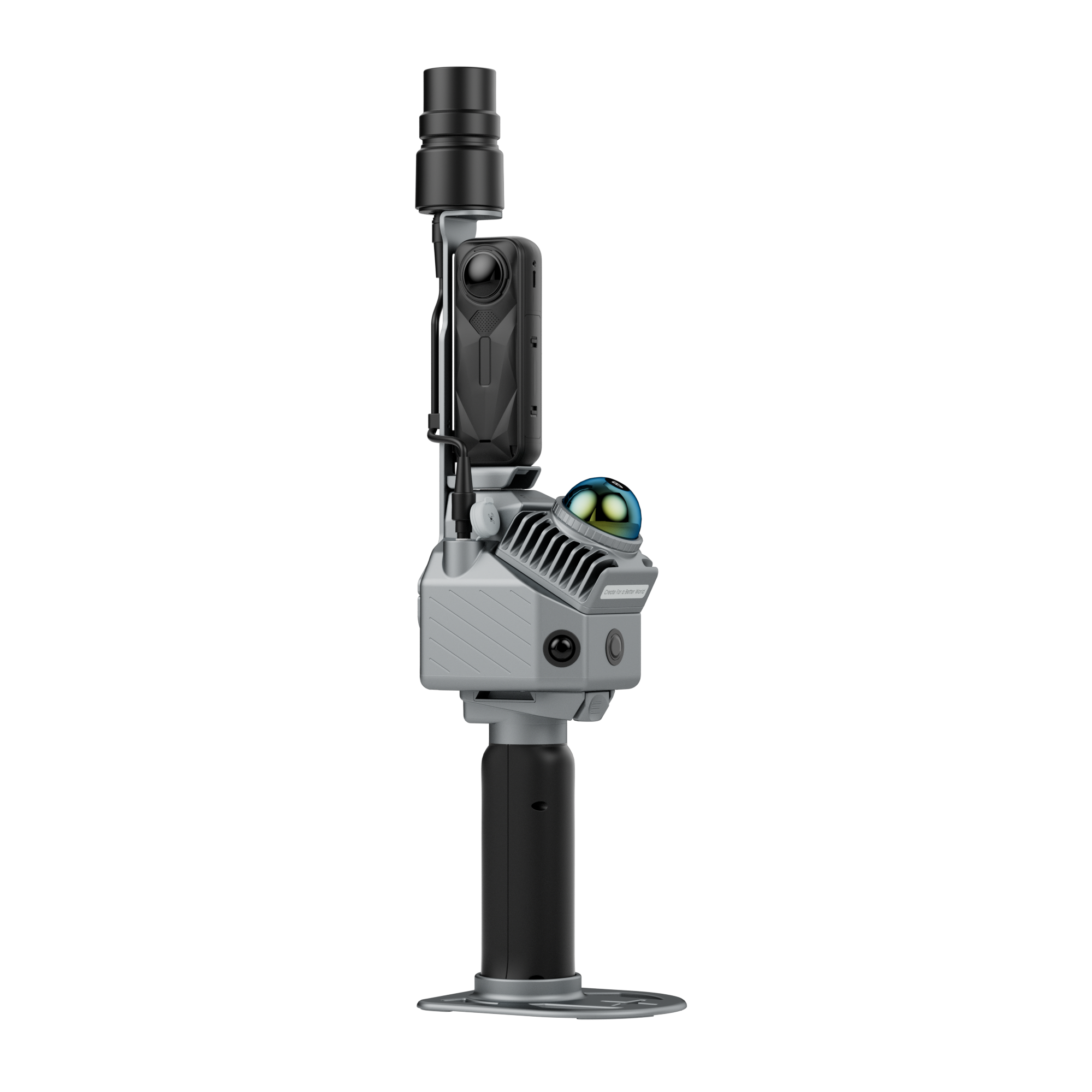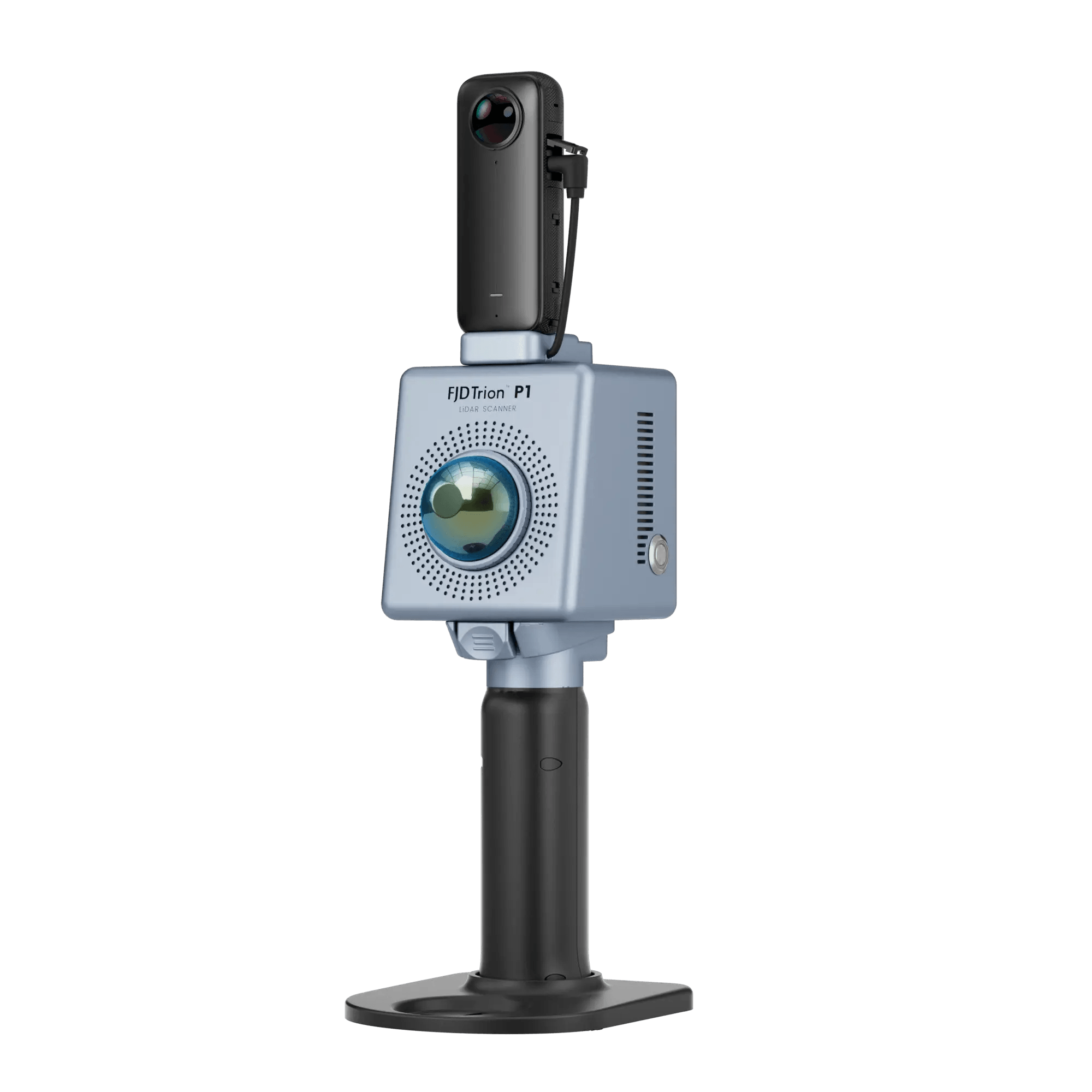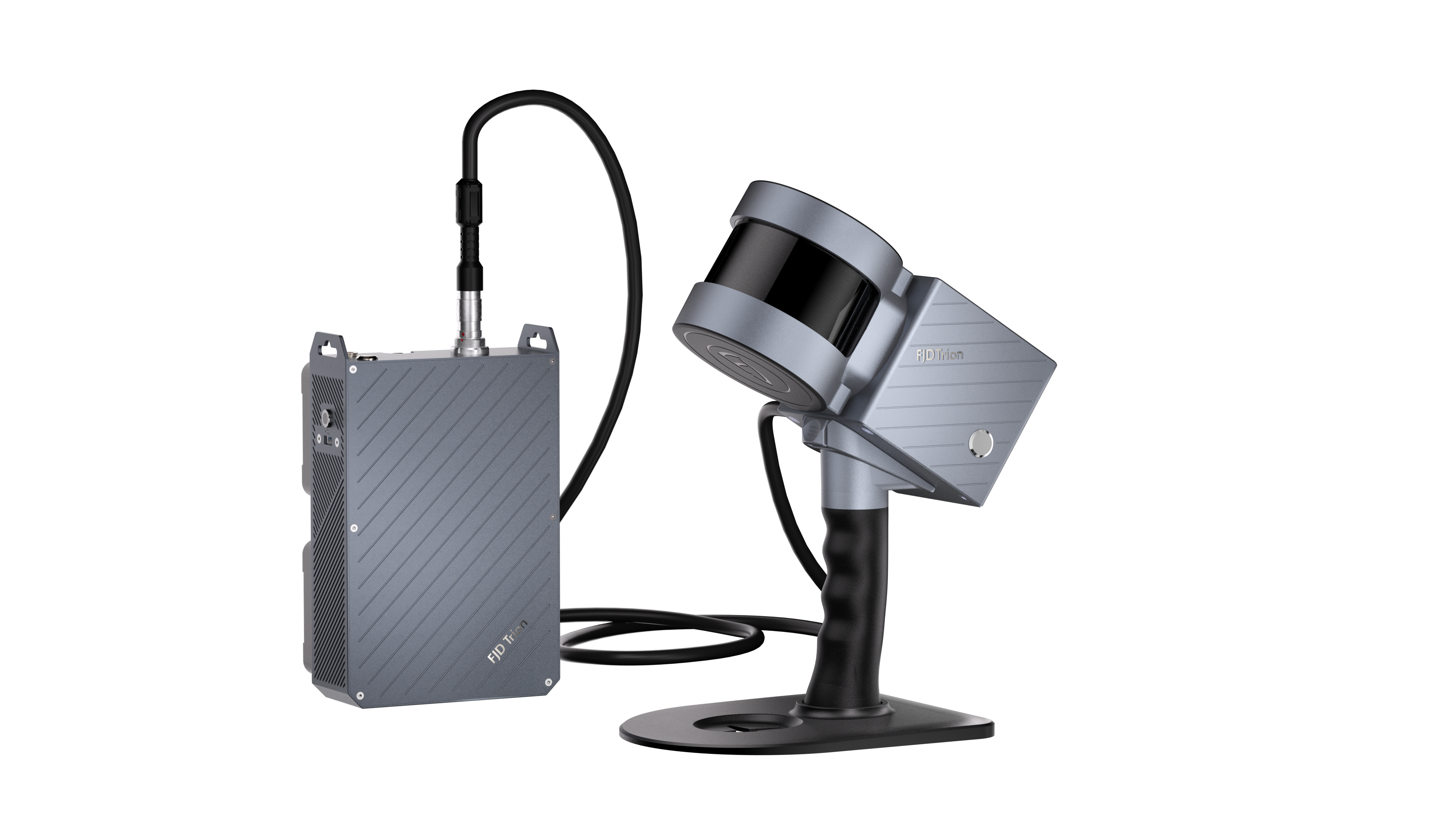
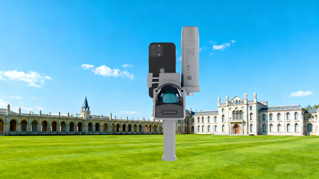


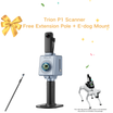


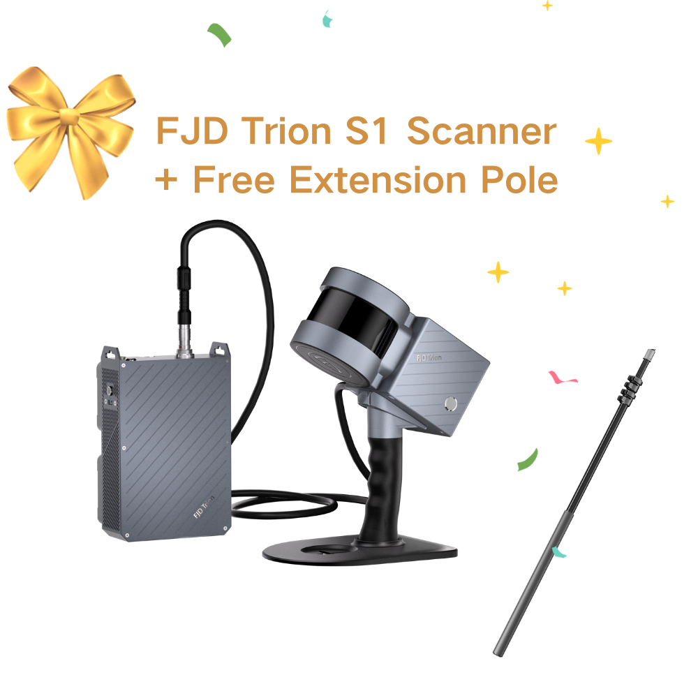
FJD Trion V4e LiDAR Kit
Subscribe Now and Save - $50 OFF
Mobile Handheld LiDAR Scanner for Fast, Accurate 3D Capture
The FJD Trion V4e LiDAR Kit is a portable, high-performance handheld LiDAR scanning solution designed to capture detailed 3D spatial data quickly and efficiently.
Whether you are mapping complex environments, capturing as-built conditions, or creating realistic 3D models, the V4e LiDAR Kit delivers dependable results with minimal setup time.
Why Choose the V4e LiDAR Kit?
Traditional 3D scanning solutions often require complex setup, tripods, or stationary platforms—and even then may take hours to complete basic captures.
The V4e LiDAR Kit transforms this process with a workflow that is:
-
Fast to deploy
-
Easy to operate
-
Accurate and consistent
-
Mobile and unobtrusive
With this kit, professionals across industries can scan confidently without sacrificing speed or quality.
Designed for Real-World Applications
The V4e LiDAR Kit supports a wide range of workflows where reliable 3D data matters:
Construction & BIM
Capture detailed as-built conditions for renovation, verification, and coordination.
Surveying & Mapping
Collect accurate point cloud data quickly across varied terrains and environments.
Facility & Asset Documentation
Generate comprehensive 3D models of buildings, interiors, and infrastructure.
Robotics & Automation
Provide rich spatial data for navigation, planning, and simulation workflows.
Simple Workflow, Powerful Results
With the V4e LiDAR Kit, you can:
-
Start scanning in minutes
-
Walk through environments with a handheld setup
-
View real-time point cloud feedback on a mobile device
-
Export high-resolution 3D data for downstream processing
This streamlined approach reduces field time without compromising on data quality.
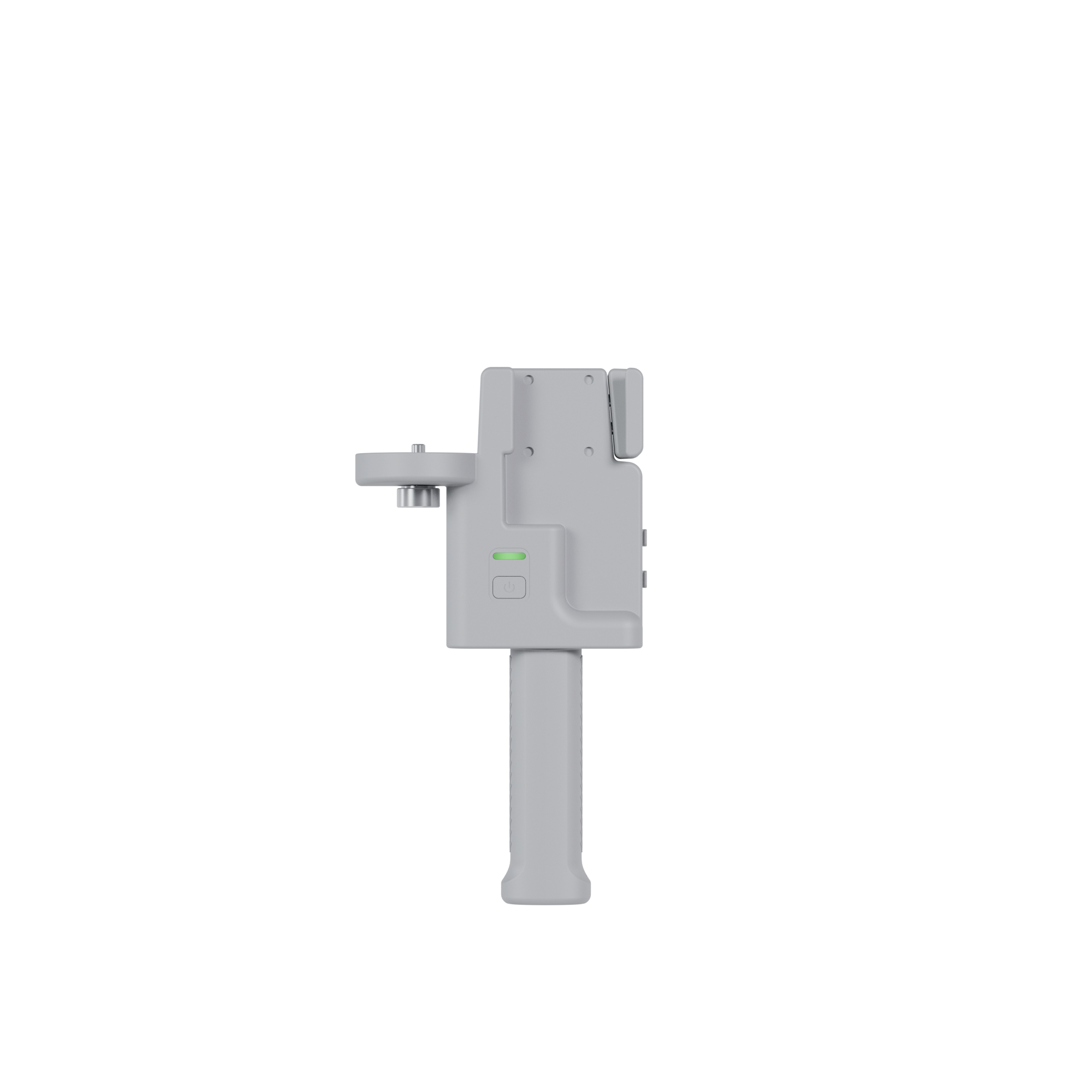
Built for Accuracy and Portability
The V4e LiDAR Kit combines robust sensing with a lightweight design that makes it ideal for:
-
Confined spaces and indoor environments
-
Outdoor scanning without extensive setup
-
Fast iteration on site
-
Teams with limited scanning experience
Its ergonomic build and mobile integration empower users to capture high-fidelity 3D data without specialized training.
Expand Your Capabilities
While the LiDAR Kit operates effectively on its own, pairing it with a precision GNSS RTK receiver (such as the FJD Trion V4e Mini RTK Receiver) enables:
-
Georeferenced 3D datasets
-
Field-ready positioning accuracy
-
Extended workflows for large projects
This flexibility allows you to scale from simple captures to professional survey-grade deliverables.
Perfect for Professionals Who Demand More
Whether you are capturing reality for BIM, documenting complex environments, or supporting robotic navigation systems, the FJD Trion V4e LiDAR Kit delivers the performance needed to turn field data into actionable insights with confidence.
![]() Get it between -
Get it between -


Unboxing & Quick Start
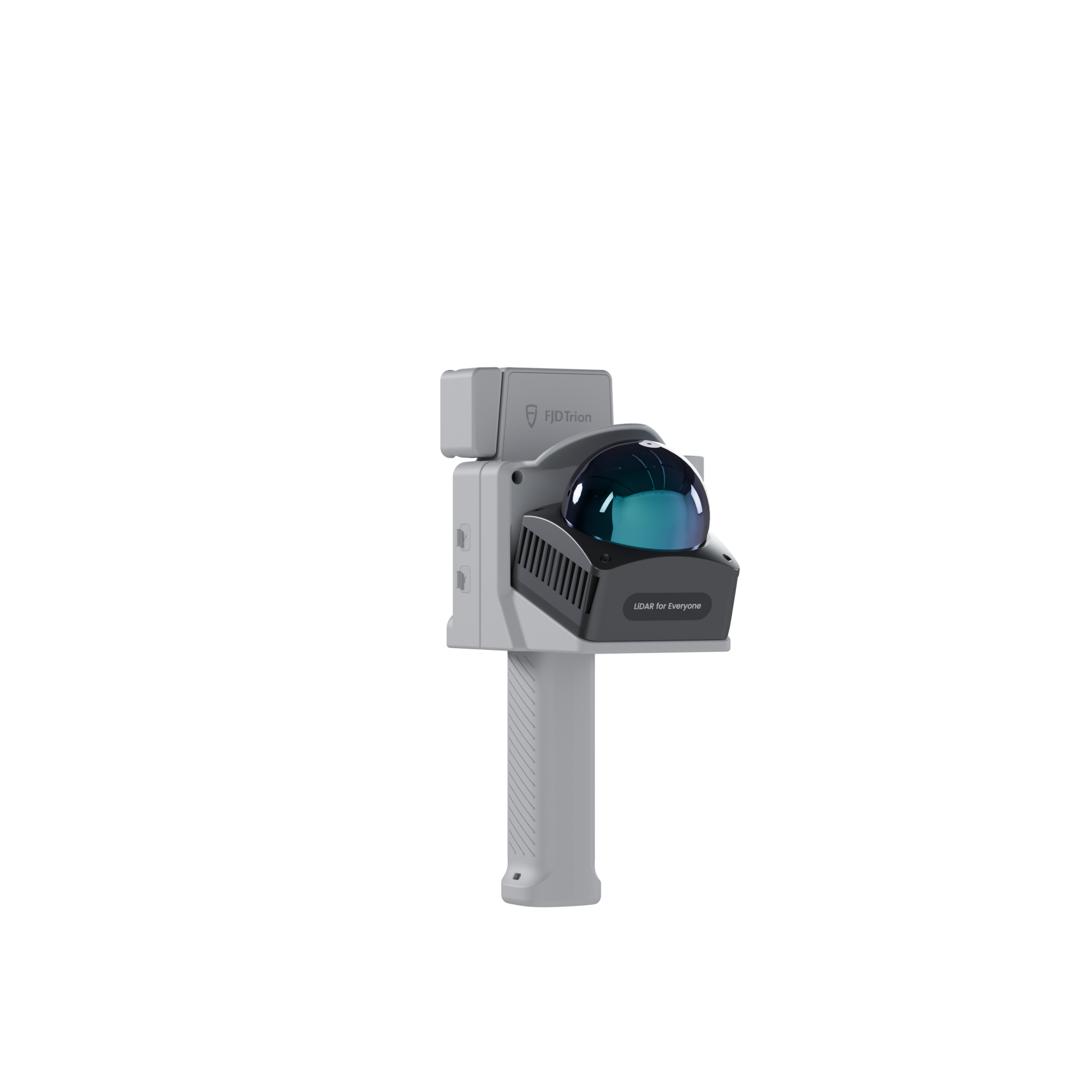
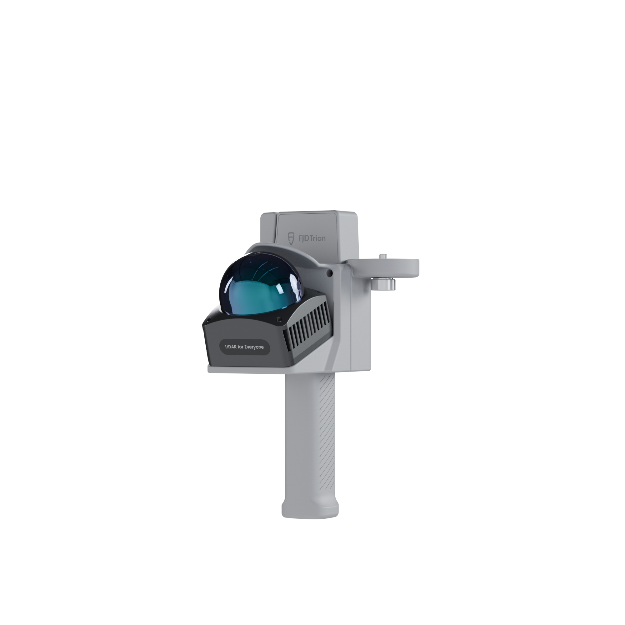
SMALL IN HAND, BOUNDLESS ON LAND
Main Features
 3cm Post-processing Accuracy |  154,600 Points per second |  50m Range @ 90% reflectivity |
 Georeferenced Point Cloud |  Extended 5-Hour Runtime |  Indoor & Outdoor Scanning |
Compact Design, Professional Precision
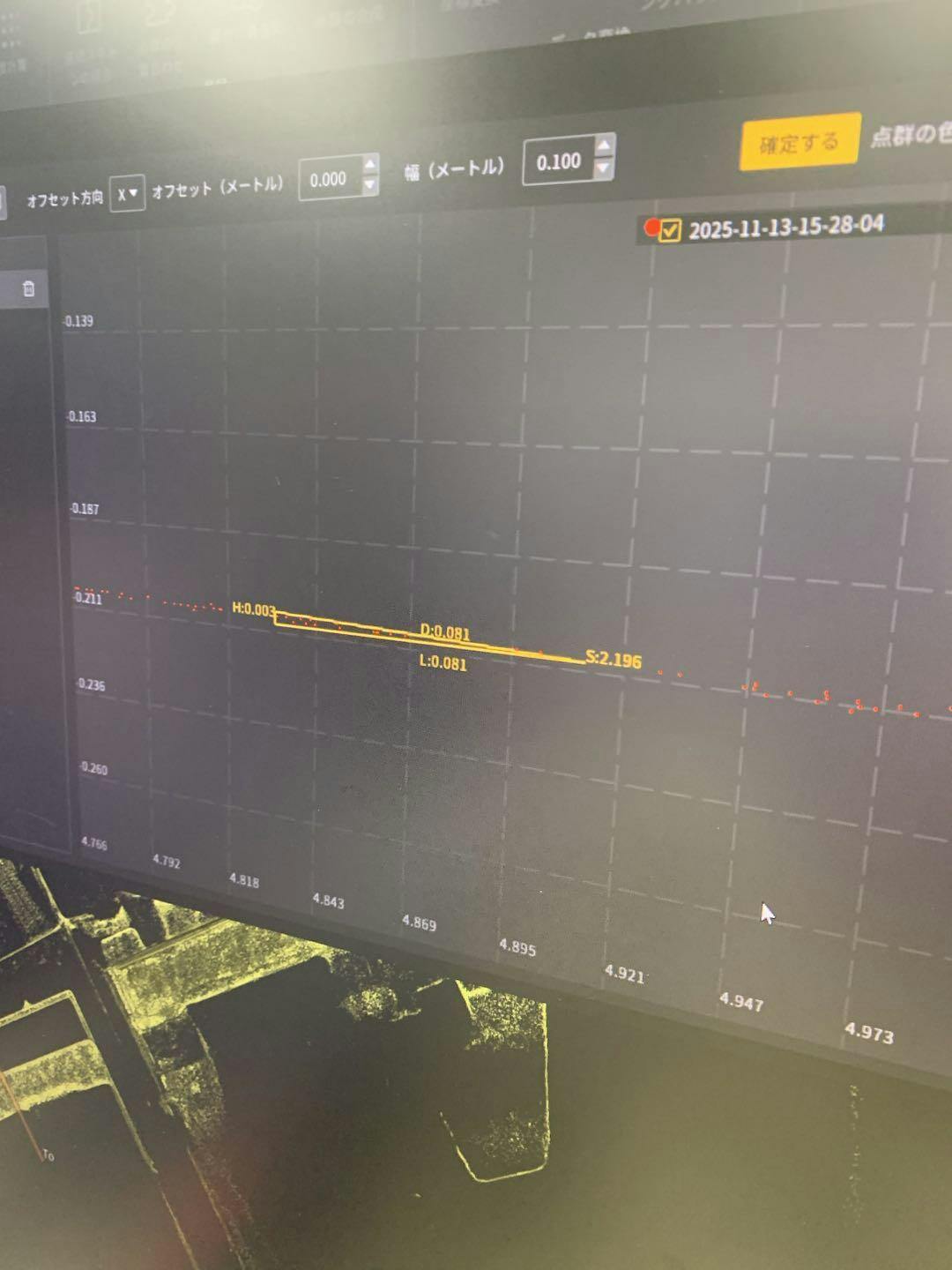
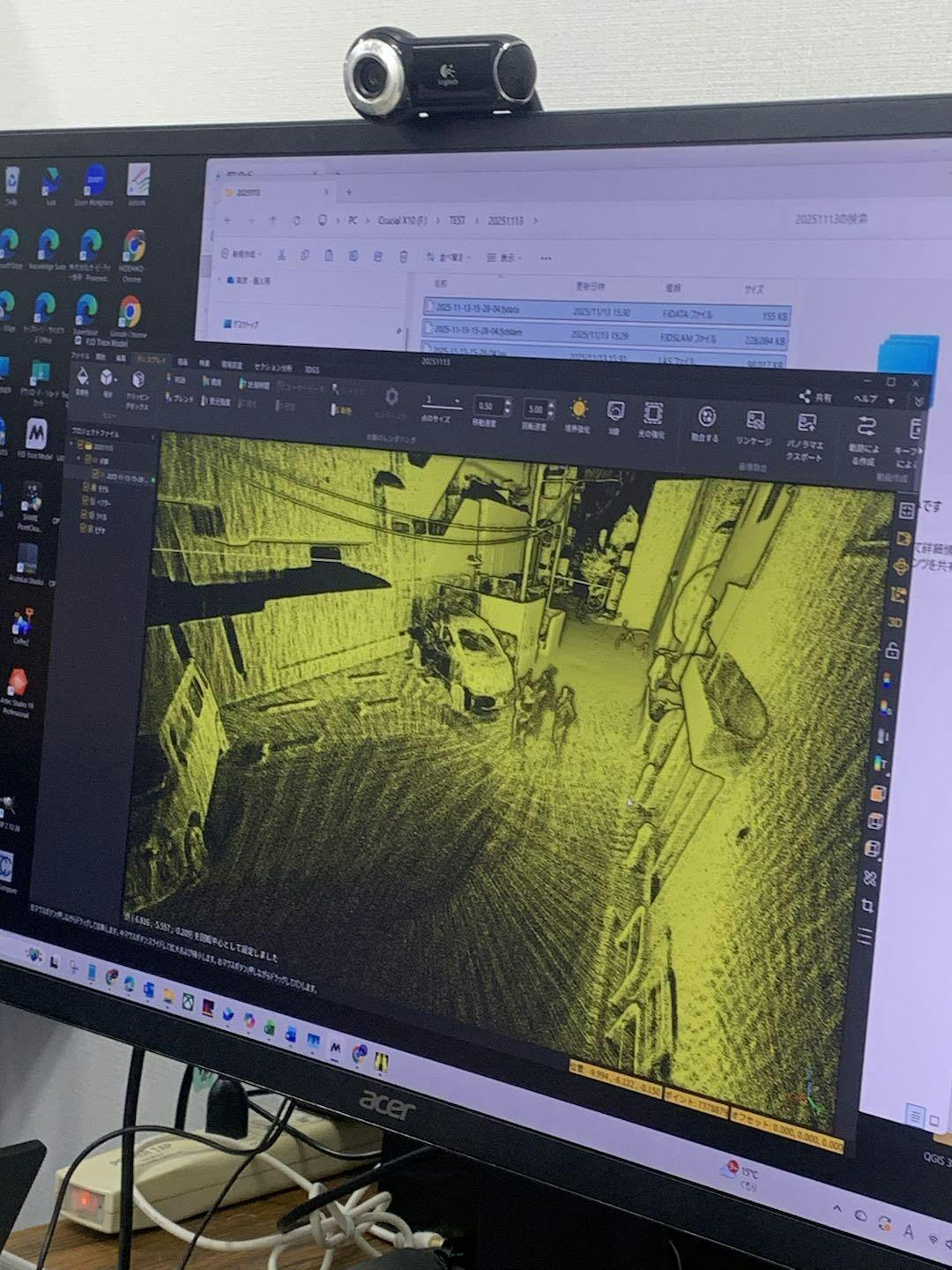
You can walk around while capturing dense point clouds and monitor your progress in real time with the Scan App, ensuring complete coverage
through real-time point cloud visualization and effortlessly obtaining colored point clouds.
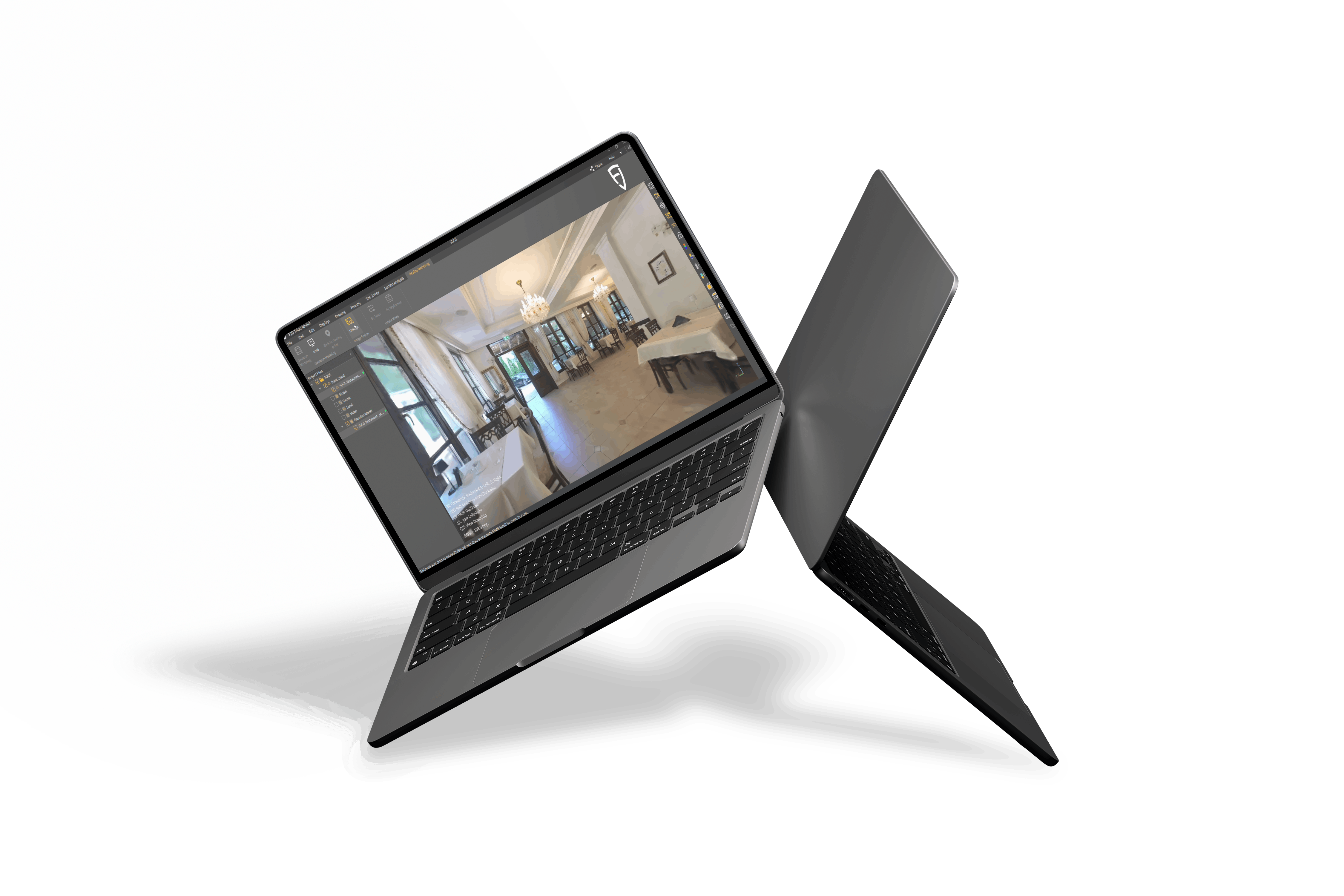
High-Quality 3D Gaussian Splatting
With data captured by the FJD Trion V4e LiDAR Kit, users can efficiently generate high-quality 3D Gaussian Splatting (3DGS) representations.
TWO FLEXIBLE SETUPS,MULTIPLE SCENARIOS
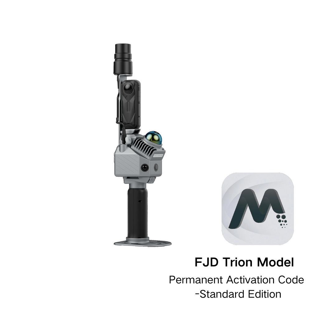
 | 1. Smartphone x V4e x LiDARIdeal for High-precision outdoor scanningBuilding facades, utility mapping and outdoor BIM projects. With RTK providing centimeter-level accuracy and the LiDAR Kit delivering dense point clouds, this setup achieves professional-grade, georeferenced 3D models. |
2.Smartphone x LiDARIdeal for Detailed indoor mapping without GNSSFacility mapping, warehouses, underground spaces, and industrial plants. When RTK signals are unavailable indoors, the LiDAR Kit still enables accurate indoor point cloud capture on your smartphone, ensuring precise layouts and reliable documentation. |  |
1. Smartphone x V4E x LiDAR
Ideal for High-precision outdoor scanning
Building facades, utility mapping and outdoor BIM projects.
With RTK providing centimeter-level accuracy and the LiDAR Kit delivering dense point clouds, this setup achieves professional-grade, georeferenced 3D models.
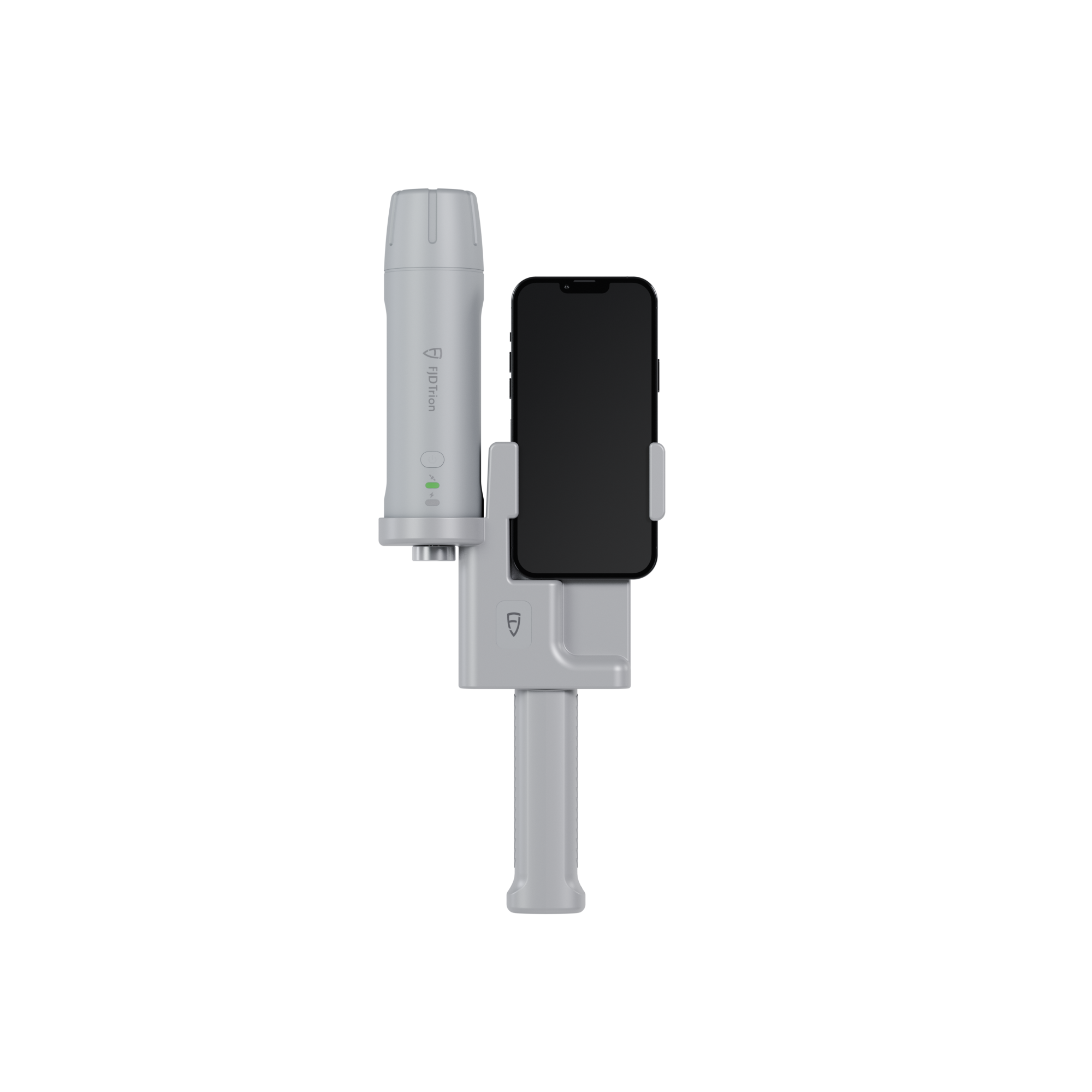
2.Smartphone x LiDAR
Ideal for Detailed indoor mapping without GNSS
Facility mapping, warehouses, underground spaces, and industrial plants.
When RTK signals are unavailable indoors, the LiDAR Kit still enables accurate indoor point cloud capture on your smartphone, ensuring precise layouts and reliable documentation.
ALL-IN-ONE SEAMLESS WORKFLOW
 | Flexible SetupTurn your smartphone and the LiDAR Kit into a scanner by simply connecting the Kit to the FJD Trion Scan App—fast assembly, plug and play, and ready to work in less than 60 seconds. |
Scan & PreviewWalk around while capturing dense point clouds. You can monitor your progress in real time with the Scan App, ensuring complete coverage through real-time point cloud visualization. |  |
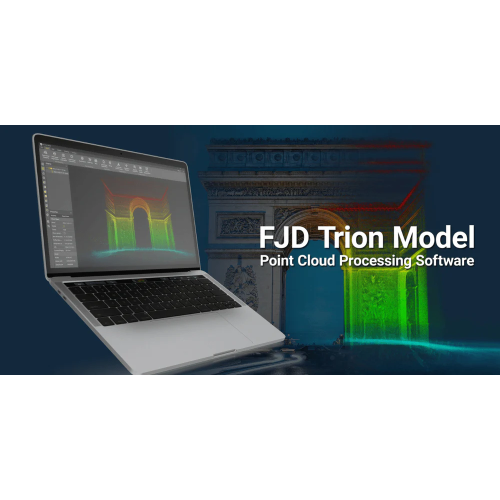
Data Processing with FJD Trion ModelImport data into FJD Trion Model for advanced processing. You can leverage multi-industry application modules such as construction, utilities, forestry, and BIM—to analyze, model, and generate actionable outputs. | |
Collaboration via Trion ExplorerUpload point clouds to the Trion Explorer for collaborative editing, data management, and secure sharing. This lets you work seamlessly with your team anytime, anywhere. |  |
Flexible Setup
Turn your smartphone and the LiDAR Kit into a scanner by simply connecting the Kit to the FJD Trion Scan App—fast assembly, plug and play, and ready to work in less than 60 seconds.Scan & Preview
Walk around while capturing dense point clouds. You can monitor your progress in real time with the Scan App, ensuring complete coverage through real-time point cloud visualization.Collaboration via Trion Explorer
Upload point clouds to the Trion Explorer for collaborative editing, data management, and secure sharing. This lets you work seamlessly with your team anytime, anywhere.
Download
Application Scenarios
 Topographical Survey |  Construction & BIM |  Utilities & Public Works |
 Road Surveying |  Forestry & Agriculture |  Quick Robotic Integration |
Topographical Survey
Construction & BIM
Utilities & Public Works

Road Surveying
Forestry & Agriculture
Quick Robotic Integration
Specifications
905nm±15n
CLASS 1 (IEC 60825-1:2014)
0.05-50m(90% reflectivity)
0.1-25m (10% reflectivity)
0.05m
H: 360°
V: -10°~60°
5cm
3cm
≥200kHz
154,600 pts/s @ 70° vertical FOV
137mm*155mm*250mm
Approx. 890g
5/8-inch internal threaded interface
-10℃~+60℃
0℃~+45℃
iOS
iPhone 15 and later models
5V/3A
3.6V/6700mA
<5W (25℃)
≤3H
≥5H
USB 3.0
Charging / USB 2.0
OTA
Comparison
Handheld LiDAR + SLAM + RTK
Handheld LiDAR + Multi-SLAM + RTK
Handheld LiDAR + SLAM (No GNSS required)
154,600 pts/s
200,000 pts/s
320,000 pts/s
50 m (90% reflectivity)
70 m (80% reflectivity)
120m
Post-processed accuracy: 3 cm
RTK accuracy: H 8 mm + 1 ppm
/ V 15 mm + 1 ppm
Relative accuracy: 2 cm
~860 g
700g
1.8kg
Indoor & outdoor scanning, mobile RTK mapping, BIM
High-precision outdoor mapping, large scenes, 3DGS
Long-range scanning, mining, tunnels, forestry
FAQs
You may find answers here. If not, please contact us directly. We will be happy to assist you.
What devices are compatible with the FJD Trion V4e LiDAR Kit?
The FJD Trion V4e LiDAR Kit only supports iOS devices, specifically iPhone 15 and later models. Android smartphones are not compatible at this time. Please confirm your iPhone model before purchasing to avoid compatibility issues.
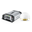
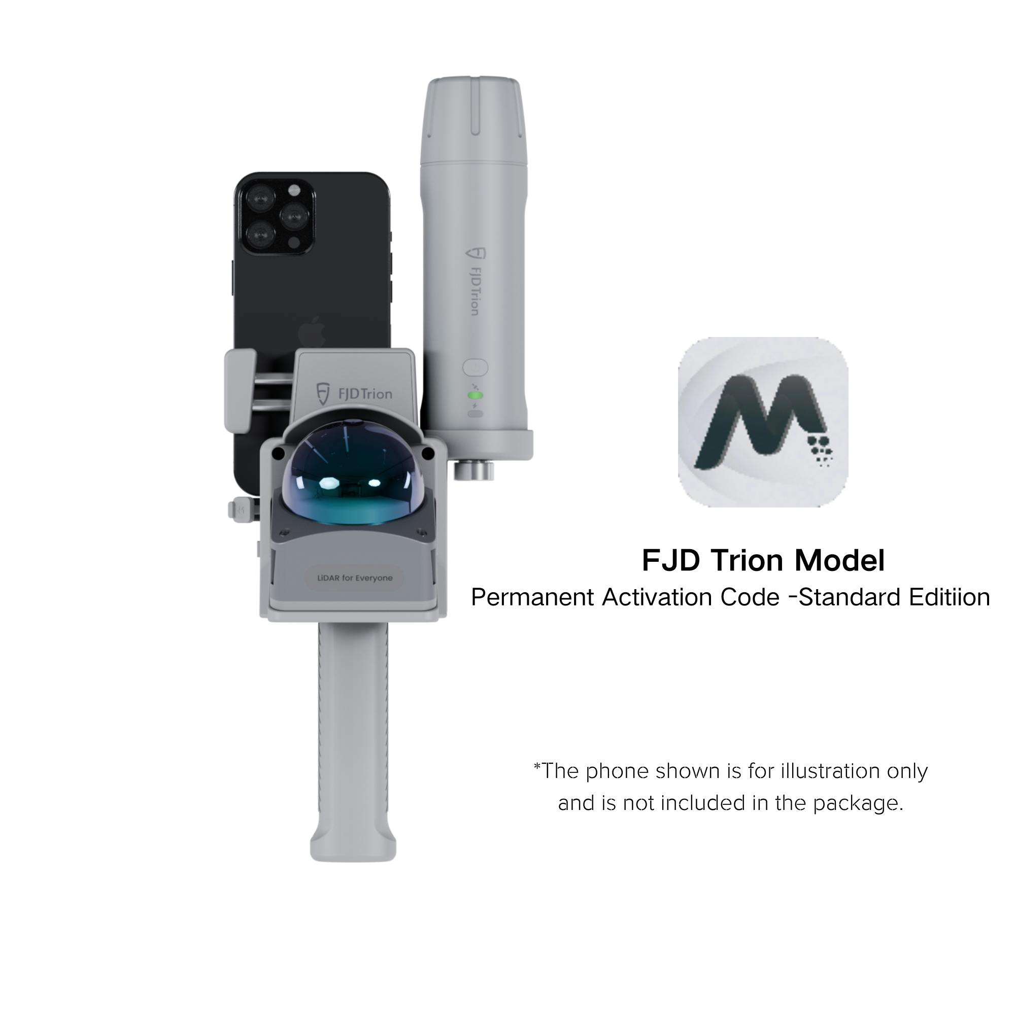
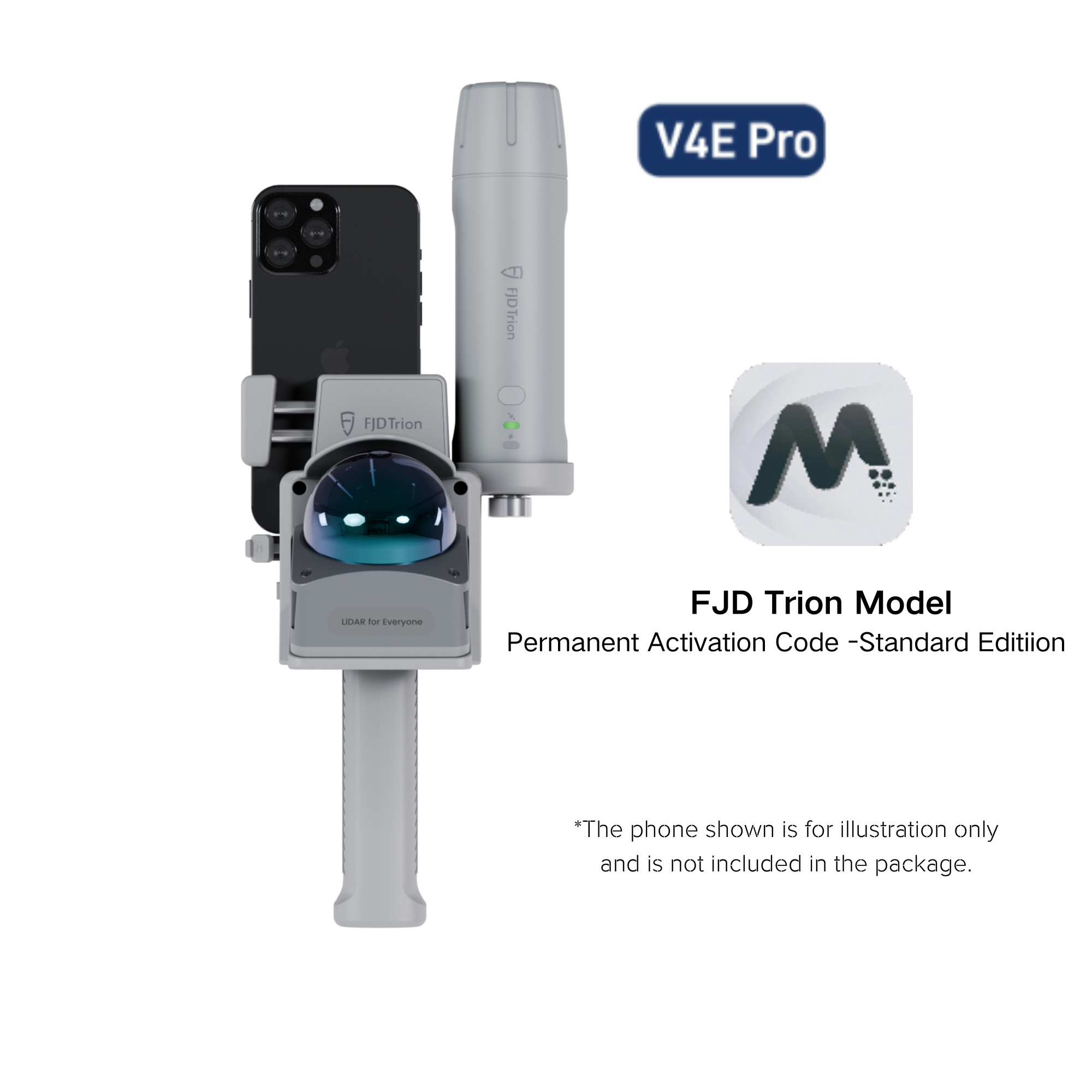
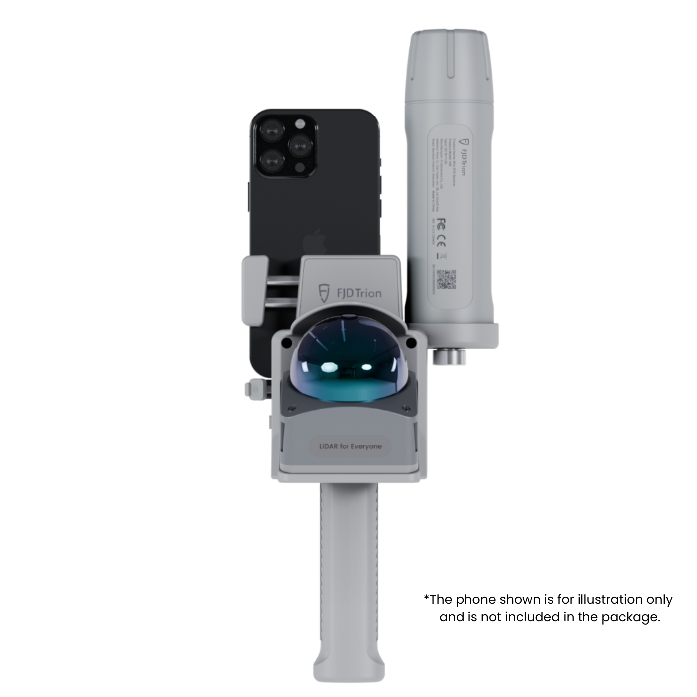
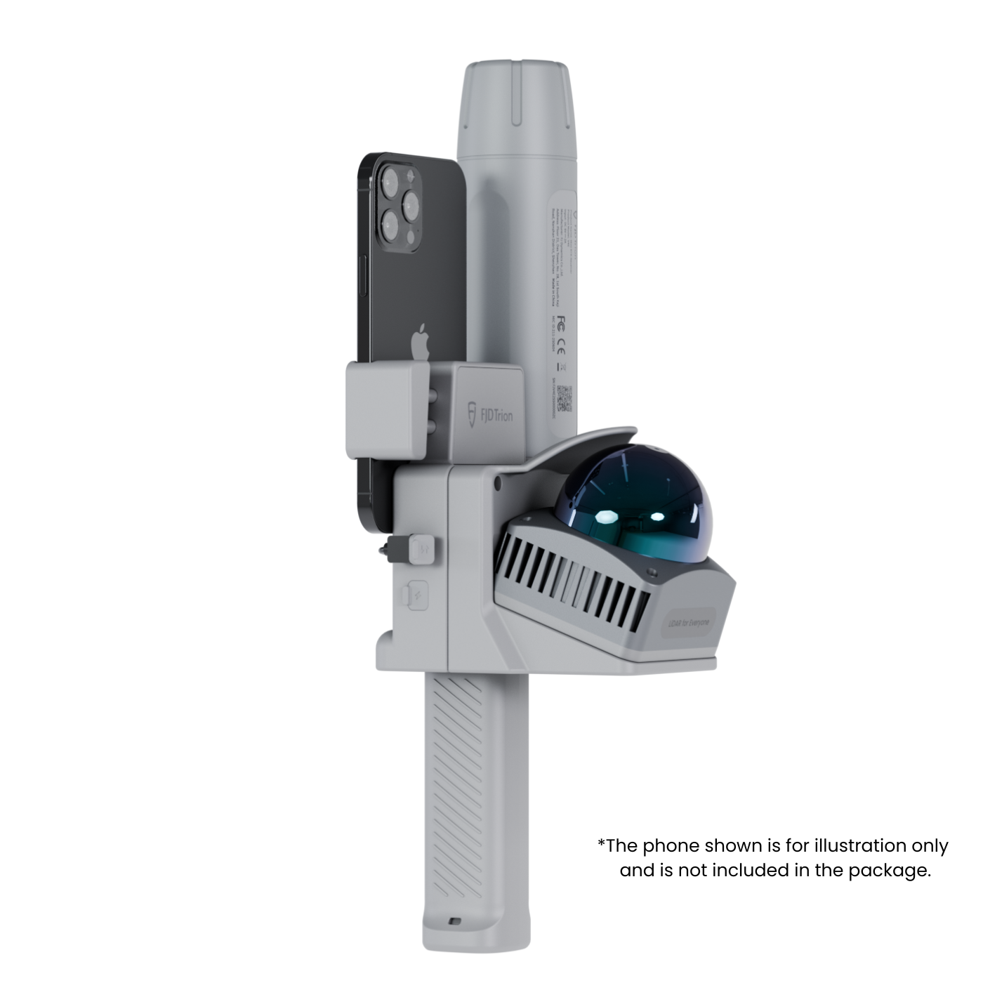
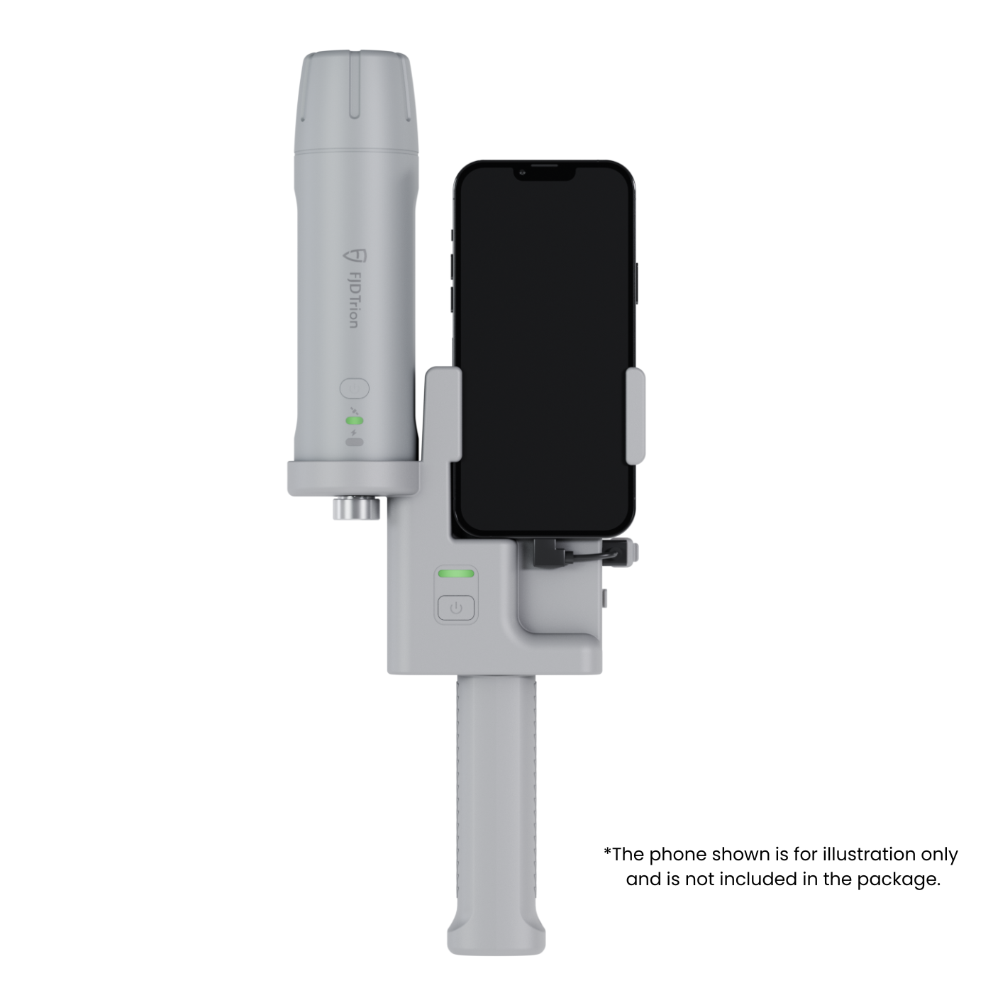
What is included in the package? Does it come with a smartphone or RTK receiver?
The package includes:
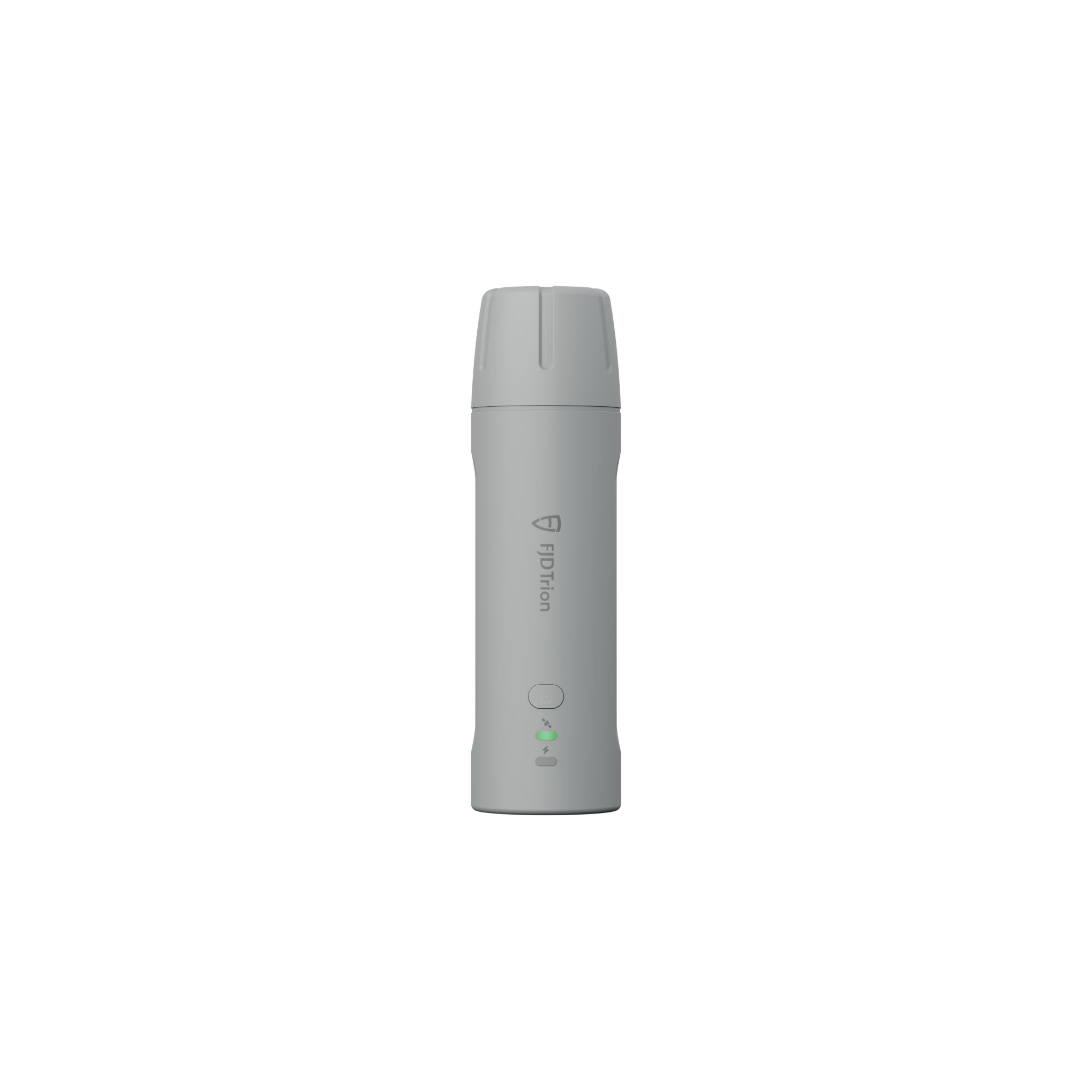
- 1 x FJD Trion V4e LiDAR Scanner main unit
- 1 x FJD Trion Model Permanent Activation Code (Standard Edition)
- 1 x Charging cable
Important notes:
- Smartphones shown in product images are for illustration only and are not included.
What is the difference between V4e LiDAR and V4e Pro LiDAR?
The only difference is the RTK receiver. The V4e LiDAR comes with a standard RTK, while the V4e Pro LiDAR is equipped with a Pro RTK receiver, which supports laser range finding and tilt measurement.
What is the difference between real-time point cloud accuracy and post-processed accuracy?
- Real-time point cloud accuracy: 5 cm. This is the accuracy of point cloud data displayed and captured in real time via the FJD Trion Scan App, suitable for quick on-site verification.
- Post-processed point cloud accuracy: 3 cm. This is the higher accuracy achieved after processing the captured data with the FJD Trion Model software, ideal for professional scenarios like construction BIM or topographical surveys that require precise results.
Can the LiDAR Kit work both indoors and outdoors? What setup is needed for each scenario?
Yes, it supports both indoor and outdoor use with two flexible setups:
- Outdoor (high-precision)
Smartphone + V4e Mini RTK Receiver + LiDAR Scanner
- Indoor (no GNSS signal)
Smartphone + LiDAR Scanner
How long is the battery life, and how long does it take to charge?
- Battery life: ≥ 5 hours of continuous operation (under 25℃, without external accessories like the RTK receiver). This is sufficient for a full day of on-site scanning.
- Charging time: ≤ 3 hours when using a 5V/3A charger (charger not included; please use a compatible charger to avoid damaging the battery).
What software do I need to use with the FJD Trion V4e LiDAR Kit? Are they free?
You will need three core software tools, all of which are free to use (with the included activation code):
- FJD Trion Scan App: For real-time scanning, point cloud preview, and data capture. Available for download from the Apple App Store.
- FJD Trion Model: For advanced data processing (e.g., generating 3D models, analyzing data for construction/forestry/BIM). Downloadable from the FJDynamics official website; requires the included activation code to unlock full features.
- FJD Trion Explorer: For team collaboration (e.g., uploading point clouds, secure sharing, collaborative editing). A free trial is available, with details on long-term access provided on the platform.
Does the LiDAR Kit support 3D Gaussian Splatting (3DGS)? How to generate 3DGS representations?
Yes, it supports high-quality 3D Gaussian Splatting. To generate 3DGS representations:
- Capture point cloud data with the FJD Trion V4e LiDAR Kit (ensure sufficient coverage of the target area).
- Import the captured data into the FJD Trion Model software.
- Use the built-in 3DGS module to process the data—this will efficiently generate immersive 3D Gaussian Splatting representations for visualization or presentation.
Is the LiDAR Scanner eye-safe? What is its laser safety rating?
Yes, it is eye-safe. The laser wavelength is 905nm±15nm, and it meets the CLASS 1 eye safety standard(IEC 60825-1:2014). This means it poses no risk of eye injury during normal use, even with accidental exposure.